Environmental baseline
Obtaining a natural capital asset map is a first step towards understanding and measuring the value of benefits derived from nature. EcoservR produces a detailed habitat map based on a range of nationally-available datasets, using a rule-based classification which assigns a habitat code to each polygon. Current codes are derived from ecological survey (Phase 1) codes, but we are working on a conversion tool to produce UKHab-compatible maps.
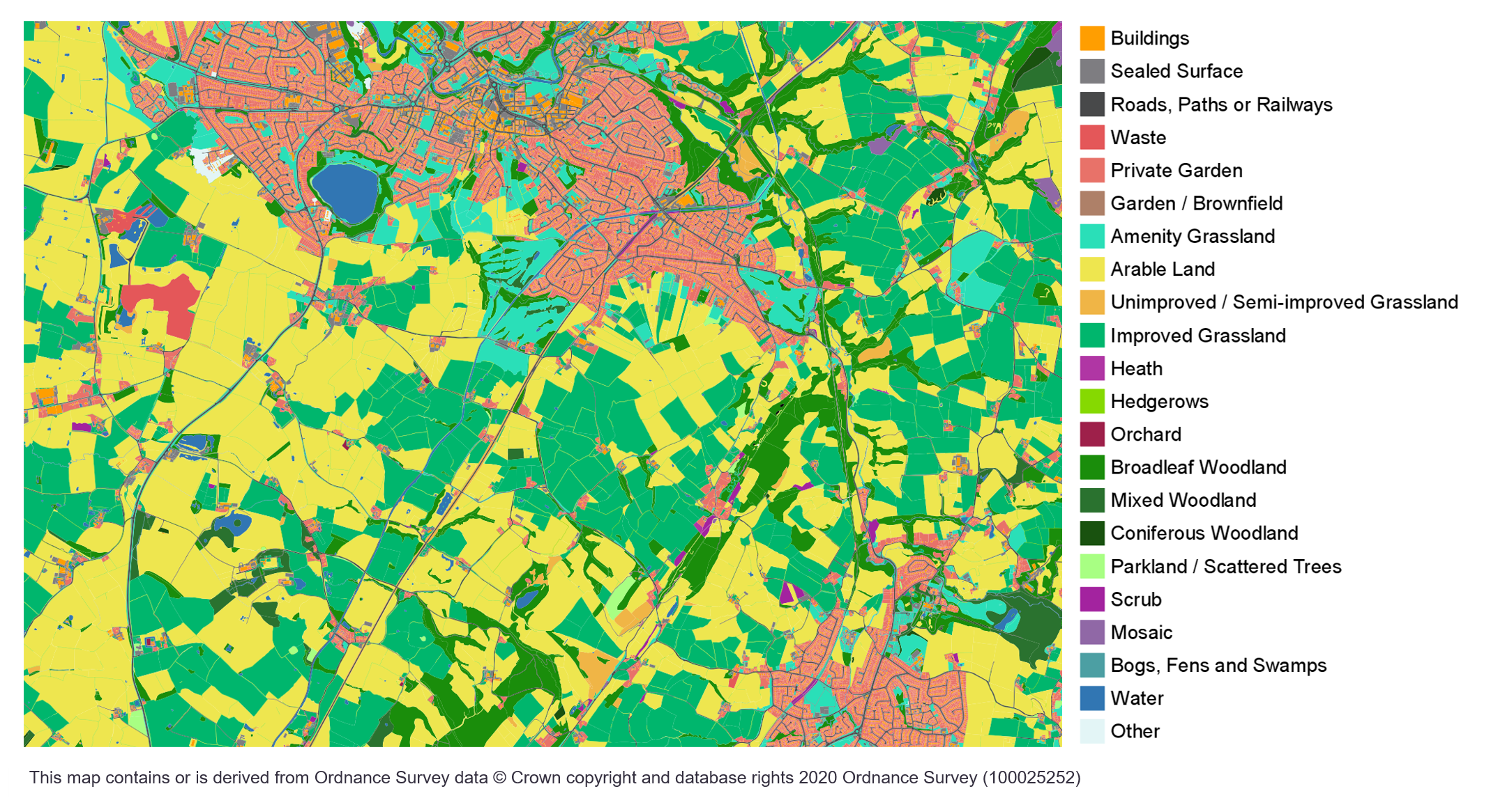 Simplified habitat map for part of the Dane river catchment around Congleton, Cheshire
Datasets
EcoservR uses nationally available datasets, most of which are free and available under an Open Government licence. Required datasets are indicated in bold, while the rest are optional. Some service models require additional layers.
- OS MasterMap (licence required)
- OS Greenspace (license required) and/or Open Greenspace
- Natural England Priority Habitat Inventory
- CORINE land cover (recommended)
- Crop Map of England (recommended)
- National Forest Inventory
- Terrain data (DTM) (required for water service models)
- Public Rights of Way (recommended for accessible nature models)
- CRoW Open Access land (recommended for accessible nature models)
- Designated sites (LNR, NNR, national parks, etc.) (recommended for accessible nature models)
- Census data (population density)
- Index of Multiple Deprivation (health data)
Note: These layers are appropriate for sites in England. We are planning to incorporate workflows for Scottish and Welsh sites next year.